
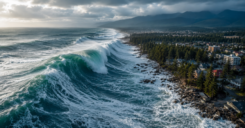
Imagine the ground beneath your feet not just shaking, but sinking a full meter as a wall of water the size of a ten-story building rushes toward your home at the speed of a commercial airliner. This isn’t the plot of a Hollywood apocalypse movie. It’s the real scientific scenario for the U.S. Northwest. For decades, popular culture has conditioned us to look with dread toward Southern California, waiting for the “Big One” on the San Andreas Fault.
- 1. The anatomy of the monster: What is the Cascadia Fault and why do scientists fear it?
- 2. The historical precedent: The day the ocean swallowed the coast
- 3. The day-after scenario: What would happen in Oregon, Washington, and California?
- The first 5 minutes: The massive quake
- The next 15 to 30 minutes: The inevitable tsunami
- The collapse of basic services
- 4. Community survival guide: How to protect your loved ones against the inevitable
- Step 1: The family communication plan
- Step 2: The 72-hour backpack (Minimum required)
- Step 3: Identify the evacuation zone (If you live near the ocean)
- 5. The impact on housing and insurance: What no one is telling you
Yet elite geologists are trembling over a completely different geographic zone—one that remains in eerie silence, building up monstrous tension that, sooner or later, will erupt.

The real danger on the West Coast
The real risk of a massive cataclysm on the U.S. West Coast doesn’t come from San Andreas, but from the Cascadia Subduction Zone, a megafault capable of generating a magnitude 9.0 or greater megaquake and a devastating tsunami simultaneously. While San Andreas scrapes plates laterally, Cascadia shoves an oceanic plate beneath the continent, acting like a fully compressed giant spring that will strike directly from Northern California to Vancouver Island.
1. The anatomy of the monster: What is the Cascadia Fault and why do scientists fear it?
To understand the danger, we must set aside what we see on TV. Not all geological faults are the same. The San Andreas Fault is a strike-slip fault; the plates slide sideways. It’s destructive, yes, but it has a physical limit: its earthquakes rarely exceed magnitude 8.2.
Cascadia plays in a different league.
It is a subduction zone, a massive 1,100-kilometer (about 700-mile) crack where the Juan de Fuca tectonic plate is forcefully wedging itself beneath the North American Plate.

The truth is the upper plate has gotten stuck. Unable to slide smoothly, it is bending and compressing like a titanium bow under extreme pressure.
The three types of earthquakes the region generates
- Shallow earthquakes: Occur within the North American Plate. They are local but can be highly destructive if they strike beneath densely populated cities like Seattle or Portland.
- Deep earthquakes: Happen in the subducting plate. The 2001 Nisqually earthquake (magnitude 6.8) is an example. They are frightening, cause structural damage, but don’t destroy entire regions.
- The Subduction Megaquake: The definitive event. The entire fault ruptures at once. The energy release is so massive it alters the region’s geography within minutes.
2. The historical precedent: The day the ocean swallowed the coast
Many think, “If it’s so dangerous, why doesn’t anyone talk about it?” The answer is simple and terrifying: because it has been dormant for so long. Written records in the U.S. are relatively recent, but the Earth does not forget.
Thanks to paleoseismology and historical records from Japan, we now know with mathematical precision when the last major rupture occurred.

The historical fact: On January 26, 1700, at 9:00 p.m., Cascadia ruptured. It generated an earthquake estimated between magnitude 8.7 and 9.2. The ground dropped suddenly, submerging entire forests that are now known as “ghost forests.” A few hours later, an orphan tsunami (so named because the preceding tremor wasn’t felt) struck Japan’s coasts with massive waves.
Scientists have calculated the time interval between these mega-events by analyzing marine sediments. Here’s what’s interesting… and concerning.
| Geological Variable | Cascadia Fault Data |
| Total length | 1,100 kilometers (From Northern California to Vancouver) |
| Last major event | January 26, 1700 (Over 325 years ago) |
| Average recurrence interval | Between 240 and 500 years |
| Probability of occurrence (Next 50 years) | ~37% for the southern section / ~10-15% for the entire fault |
| Maximum potential magnitude | 9.0 – 9.2 on the Richter scale |
What does this mean for us? That we are within the time window. Earth’s biological clock is ticking, and the safety margin is running out.
3. The day-after scenario: What would happen in Oregon, Washington, and California?
If the fault ruptures completely tomorrow, the impact will be unlike anything modern U.S. society has ever experienced. We’re not talking about a tremor where kitchen shelves fall; we’re talking about the total paralysis of a key economic region.
The first 5 minutes: The massive quake
The shaking won’t last 30 seconds like in San Francisco. A magnitude 9.0 earthquake means 4 to 6 minutes of violent, uninterrupted shaking.
The ground will liquefy in low-lying areas (liquefaction effect), causing entire buildings to collapse on their foundations or sink as if built on gelatin. Key highway bridges, like those on I-5, which aren’t prepared to withstand such prolonged punishment, will collapse en masse.
The next 15 to 30 minutes: The inevitable tsunami
For those living on the coasts of Oregon or Washington, the earthquake is just the warning alarm. The vertical displacement of the seafloor will push a colossal mass of water.
The waves will take between 15 and 30 minutes to hit the coast. Entire tourist towns could be wiped off the map if the population doesn’t evacuate on foot to higher ground immediately.
[Coastline] ----> (15-30 min) ----> Tsunami Impact Zone
    |
    |--> Roads blocked by the quake
    |--> Vertical evacuation routes (Only viable option)
The collapse of basic services
The Federal Emergency Management Agency (FEMA) has projections that would keep anyone awake at night. It’s estimated that everything west of Interstate 5 will be rendered unusable.
Without electricity, drinking water, cell service, and with fuel refineries destroyed, major cities like Seattle and Portland will become logistical islands. Aid will take days, even weeks, to reach the hardest-hit areas.
4. Community survival guide: How to protect your loved ones against the inevitable
Does this mean we should sell everything and move tomorrow? Not necessarily. Preparation makes the difference between being a victim or a survivor. The Hispanic community in the Northwest is hardworking and resilient, but sometimes we fall short on structured prevention. Improvisation won’t work here.
Step 1: The family communication plan
Where will you meet if the quake strikes in the middle of the workday or school hours? Local lines will collapse.
- Golden rule: Designate a family member who lives in another state (for example, in Texas or Florida) as the central contact point. It’s easier for a long-distance text message to go through than local calls.
Step 2: The 72-hour backpack (Minimum required)
Forget about the emergency kits from the supermarket that only include a couple of bandages and a cheap flashlight. Your backpack should be a lifeline.
- Water: One gallon per person per day (water is the first thing to get contaminated or cut off).
- Food: Easy-open canned goods or high-energy calorie bars.
- Documents: Physical and digital copies (on a waterproof USB drive) of birth certificates, IDs, property deeds, and insurance policies.
- Essential tools: A hand-crank radio (to tune into emergency alerts without relying on batteries), tactical flashlights, and a whistle for rescue.
Step 3: Identify the evacuation zone (If you live near the ocean)
If you live or work in coastal communities like Seaside, Newport, or Aberdeen, memorize the signs printed with the silhouette of a wave climbing a hill.
- Lesson learned: After the earthquake, don’t try to get in your car. Roads will be cracked and blocked by panicked drivers. Walk quickly, run if necessary, to an area at least 30 meters (100 feet) above sea level.
5. The impact on housing and insurance: What no one is telling you
Here’s the uncomfortable truth that real estate agents prefer to gloss over in sales brochures. Most standard homeowners insurance policies in Washington and Oregon do NOT cover damage from earthquakes or tsunamis.
Do we really want to blindly assume that financial risk? Probably not, but that’s the current market reality.
If you already own a home or are thinking of buying in the region, you need to proactively check:
- The earthquake clause: It must be purchased as additional coverage or an endorsement. It usually has high deductibles (between 10% and 20% of the property’s value), but it prevents total loss.
- Structural mitigation: Wooden houses built after the 1990s generally perform relatively well in earthquakes because they are flexible. However, older properties need to be “secured” to their concrete foundations with steel bolts (a process known as seismic retrofitting).
Image:ElHispanoParaTodos/PRESS